In a country vulnerable to various disasters, including floods, landslides, avalanches, earthquakes, and heavy rainfall, the need for reliable disaster risk reduction (DRR) tools is evident. In fact, since January 2022, 267,000 Afghans were affected by disasters, with 36,269 houses damaged or destroyed.
From Data to Action: iMMAP Inc. Unveils Powerful Tool for Disaster Response in Afghanistan
iMMAP Inc. is taking a significant step in bolstering disaster preparedness and response efforts in Afghanistan with the launch of its innovative geospatial platform, the Humanitarian Spatial Data Center (HSDC).

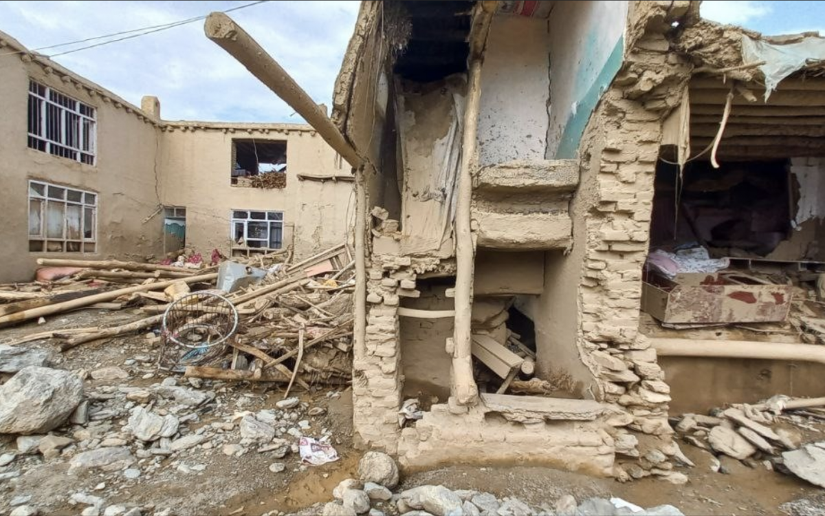
A house washed away by flash flood in Maidan Wardak Province, Afghanistan, July 2023. Picture by Rafi, used with permission.
At the same time, the country lacks advanced geospatial platforms to support disaster preparedness and response efforts. On August 21, 2023, iMMAP Inc. launched the Humanitarian Spatial Data Center (HSDC). This cutting-edge, web-based geospatial platform leverages the most reliable geospatial and non-geospatial data, providing data and analytics on demographics, disaster risks, climatic changes, and more.
With HSDC's accurate data, aid organizations can develop disaster preparedness strategies and more precisely gauge the immediate and long-term impact on communities and infrastructure.. Furthermore, HSDC enables aid organizations across the country to collaborate and coordinate with each other seamlessly, as well as exchange invaluable datasets and insights.

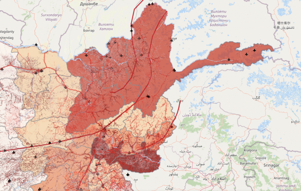
HSDC Interactive map highlights the area at high risk of earthquakes.
Exploring HSDC's Range of Capabilities
- HSDC has the capability to identify regions susceptible to natural disasters. For instance, the map provided depicts the high earthquake risk areas in the Badakhshan region and its environs in northeastern Afghanistan. This detailed mapping offers valuable insights into population density, infrastructure, and settlements. This information not only keeps vulnerable populations informed about potential natural hazards but also equips aid agencies with essential data for proactive evacuation efforts, significantly improving the efficiency of disaster response.
- Additionally, HSDC provides a roadmap on how to access the areas from the moment a crisis emerges. It details essential aspects such as primary routes leading to the disaster zone, the potential number of river crossings, and the specific risks en route (e.g., landslides).Additionally, the platform guides the strategic placement of logistic hubs and identifies the nearest airstrips. This strategic information is paramount in guaranteeing a swift and effective response, enabling aid organizations to navigate challenges and swiftly reach those in need.
- HSDC provides easy-to-use WebGIS functionality to all users. Beyond accessing the platform's disaster risk and operational data catalog, users can upload their own data and create interactive WebMaps to enhance their programming. The launch of HSDC marks a significant stride in bolstering Disaster Risk Reduction (DRR) efforts in Afghanistan. Aid organizations can now utilize this platform to effectively mitigate disaster impacts and ensure the safety, recovery, and resilience of affected communities.

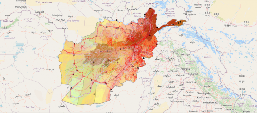
HSDC interactive Map highlighting Afghanistan's seismic intensity.
Building on its success and commitment to excellence, iMMAP Inc. introduced the platform to Afghanistan’s humanitarian community as an early access phase, this allowed selected users to test its advanced features of the platform and offer feedback, shaping the platforms’s ongoing development to meet the needs of the humanitarian partners working in the country.
About iMMAP Inc. Afghanistan
iMMAP Inc. is an international not-for-profit organization. Funded by USAID, iMMAP has been actively engaged in Afghanistan since 2007, delivering Information Management (IM) products and services to key partners involved in disaster risk reduction and humanitarian response. For more information, contact: rep-afghanistan@immap.org


