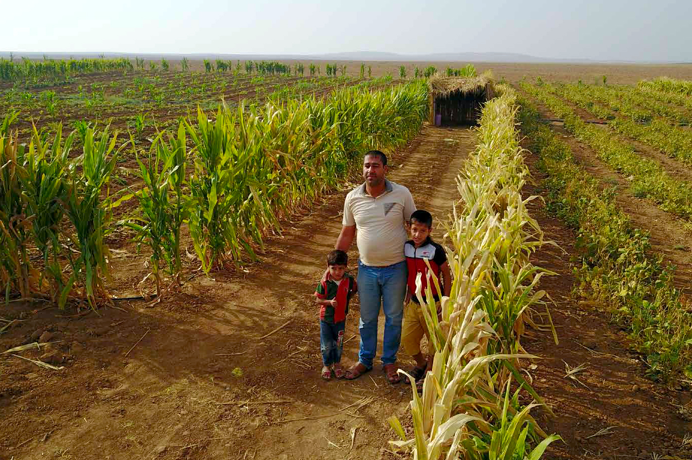
Photo: WFP - Iraq Socio-Economic Atlas 2019
Supporting the Agriculture Sector in Iraq through Humanitarian Mine Action Data
iMMAP supports the agricultural sector in Iraq by directing Iraqi authorities to focus on explosive hazard reduction on agricultural land targeted for humanitarian assistance.
The war against ISIS had a major impact on the agriculture sector in Iraq. Although it has been three years since the end of the conflict, the agricultural sector continues to face serious challenges in increasing productivity. High levels of explosive ordnance contamination in the areas liberated from ISIS led to the displacement of numerous farming communities and continue to limit access to farming land, impeding Iraq's agricultural capacity from reaching its full potential to supply food to the nation.
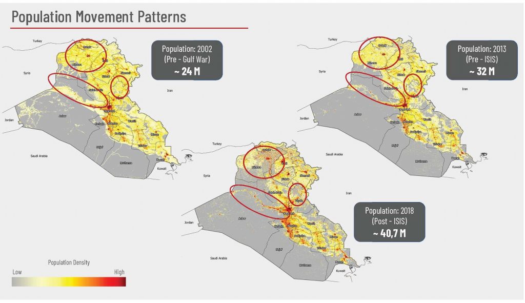
The below maps show how ISIS forced populations to abandon their rural lands and seek refuge in urban areas.

Population density in Iraq before and after ISIS operations
In the Anbar and Ninewa provinces, the Agency for Technical Cooperation and Development (ACTED) and the World Food Programme (WFP) work together to increase agricultural productivity, rehabilitate deteriorated water canals, and reduce the risks of natural and man-made hazards through a project that promotes resilience, social and environmental sustainability. However, heavily impacted by the war, the farmlands of Anbar and Ninawa are riddled with explosive ordnance, which impedes humanitarian action by posing a deadly risk to anyone entering the land.
To overcome these constraints, iMMAP Iraq is providing common operational picture (COP) maps and technical support to the Directorate of Mine Action and other relevant authorities in identifying hazardous areas in target locations, in order to eradicate this risk to project implementation and promote the safe delivery of humanitarian assistance to these communities.

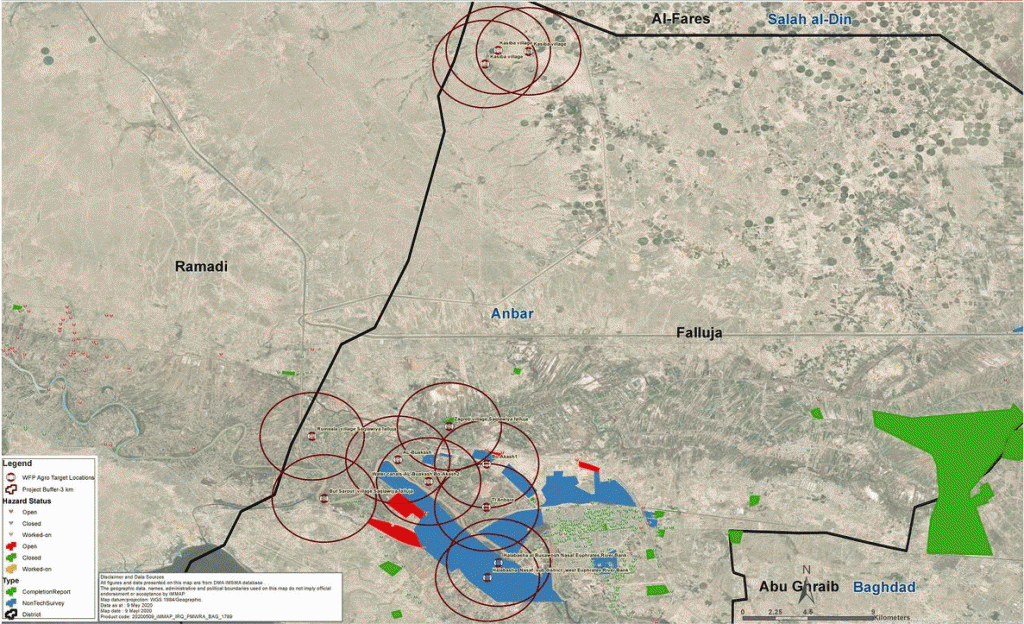
Maps of the WFP project locations in the Anbar and Ninewa Provinces
iMMAP Iraq’s Information Management (IM) team in Baghdad produced 14 maps as the foundation for a comprehensive assessment on the potential hazards to project locations, highlighting areas cleared from explosive hazards, areas with ongoing mine clearance activities and areas still contaminated by explosive hazards within a three-kilometer radius of the project locations.
These maps provide the Iraq Directorate of Mine Action (DMA) and humanitarian partners with an overview of the areas where explosive hazard reduction activities need to be prioritized to enable humanitarian support operations to local communities.
The existing mine action data which is processed and visualized by iMMAP is proving to be a cross-cutting tool instrumental in supporting the humanitarian mine action efforts and subsequently other humanitarian sectors that rely on safe access to people in need. The data has become important in post-conflict damage assessment, signaling development blockages, tracing population movement trends as well as disaster risk reduction.
Supported by the US Department of State, Office for Weapons Removal and Abatement (PM/WRA), iMMAP continues to provide technical support to the Iraqi government and its partners to establish a common operating picture (COP), to effectively task and manage explosive ordnance mitigation activities across the country.

