The use of geospatial data during humanitarian crises is critical for effective coordination, prioritization of areas of intervention, and resource allocation. The digital divide within the humanitarian sector in Ukraine, particularly in the use of GIS, technologies, is a pressing concern. Many organizations, especially those with limited resources or based in remote areas, find it challenging to access or utilize geospatial data capabilities effectively.
Bridging the Digital Divide for GIS Solutions in the Humanitarian Field
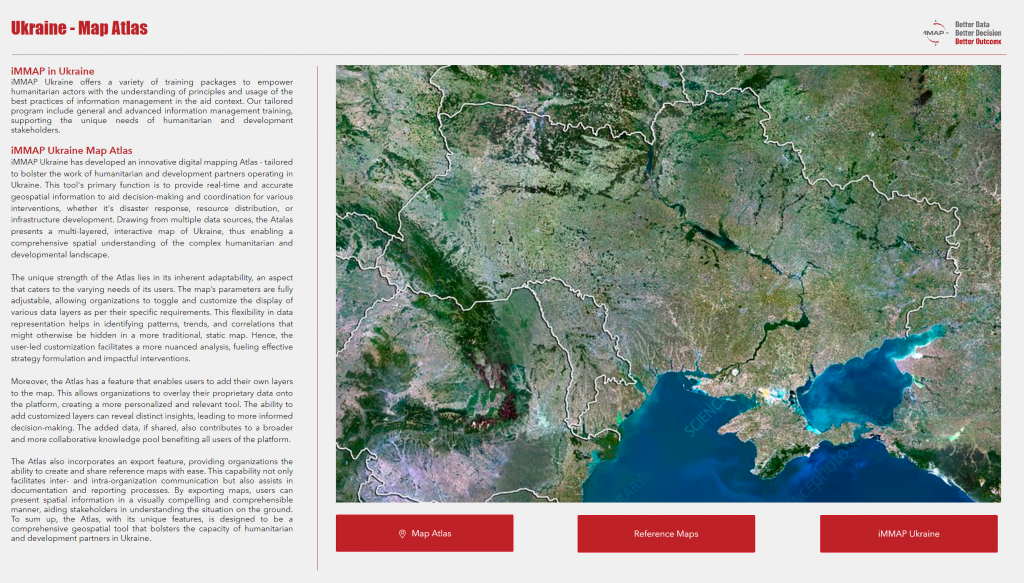
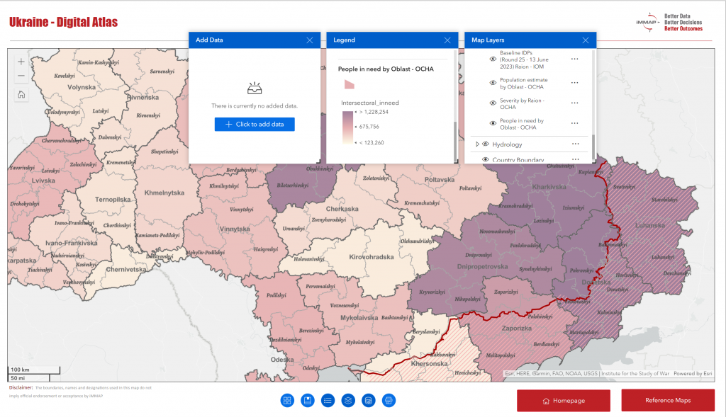
iMMAP Inc. Ukraine developed the Ukraine Digital Atlas. This innovative GIS tool facilitates the planning and implementation of humanitarian activities through easily accessible and customizable mapping.
"This divide can lead to unequal opportunities for delivering aid, strategizing interventions and understanding the humanitarian landscape. iMMAP inc. is constantly working to directly target this digital divide and facilitate the localization of response by empowering local actors with training sessions and developing accessible and user-friendly GIS tools. By adapting the technology to suit non-GIS specialists from international and national organizations, and integrating open-source data, iMMAP's initiative ensures that geospatial analysis is within reach of a broader spectrum of humanitarian actors. This approach aims to foster a more equitable digital environment within the humanitarian community."
As part of iMMAP's Inc. commitment to delivering information management services to the partners to support the most vulnerable populations, iMMAP Inc. Ukraine team developed an interactive Digital Atlas - a comprehensive GIS tool that provides accurate geospatial information in a user-friendly and integrated manner: Ukraine Digital Atlas. Drawing from multiple data sources, the Atlas presents a multi-layered, interactive map of Ukraine, enabling a comprehensive spatial understanding of the complex humanitarian and developmental landscape. One of its strongest features is that the tool is straightforward, easy to use and adapted for people with a minimal understanding of IM: both specialists and non-IM technical specialists can easily produce maps to support their and their partners’ own operational activities, and transform complex data into visually attractive and intelligible information, even while lacking GIS capacity.
Another unique strength of the Atlas lies in its inherent adaptability, as maps parameters are fully adjustable, allowing organizations to toggle and customize the display of various data layers as per their specific requirements. The Atlas combines a variety of open-source geospatial information in one repository, available to all humanitarian actors. The flexibility in data representation helps in identifying patterns, trends, and correlations that might otherwise be hidden in a more traditional, static map. User-led customization facilitates a more nuanced analysis, fueling effective strategy formulation and impactful interventions. Furthermore, export functionality enables users to print the digital adjusted maps in high quality after exporting it in PDF or PNG format.
Last but not least, the Atlas has an in-build functionality enabling users to add their own layers to the maps. This allows organizations to overlay their data with existing geo-spatial information, creating a more tailored and contextually relevant tool. The ability to add customized layers enables more in-depth analytical insights, leading to better informed decision-making. The Atlas also has a separate section with already prepared reference maps, where users can find, download, and print national reference maps of Ukraine and of all Ukraine's macro-regions.
Our expertise in geospatial analysis, combined with in-depth knowledge and experience of humanitarian and development contexts, puts iMMAP in a unique position to continue improving the impact and effectiveness of data-driven efforts to assist affected populations. By harnessing iMMAP’s GIS solutions, humanitarian organizations in Ukraine can ensure that their missions are thoroughly prepared, expertly managed, and efficiently executed, ultimately maximizing the effectiveness of humanitarian endeavors.
Ukraine Digital Atlas was developed by iMMAP Inc. Ukraine within the project 'Provision of Information Management Support to Ukraine Crisis Response Clusters', funded by USAID Bureau of Humanitarian Assistance (BHA).


